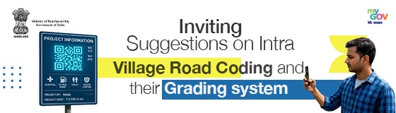
The Ministry of Panchayati Raj, Government of India, in collaboration with MyGov, invites citizens, local communities, Panchayati Raj Institutions, experts, practitioners, and stakeholders across India to participate in a public consultation on the proposed Intra-Village Road Coding and Grading System.
The Government of India is taking a pioneering step towards transforming the lives of millions of citizens in rural areas through Grameen Bharat. For the first time, the country will have a standardised digital system to code and grade every internal road within villages. This initiative has been conceptualised and spearheaded by the Ministry of Panchayati Raj and will be implemented through a whole-of-government approach involving multiple Ministries, Departments, and agencies working together.
A public consultation document on the proposed Intra-Village Road Coding and Grading System has been prepared, and the Ministry invites suggestions and feedback from citizens, local communities, and stakeholders before the system is finalised.
The Problem Being Addressed:
India has an extensive rural road network developed under various government schemes. However, internal roads within villages have never been systematically documented or mapped, leading to several challenges:
• Ambulances responding to medical emergencies often face difficulty locating the correct lane or pathway.
• Postal workers and courier services are unable to navigate accurately to specific village addresses.
• Government officials lack a reliable database for planning road maintenance and infrastructure development.
• Emergency services such as fire and police vehicles lose valuable time locating destinations.
• Digital maps and navigation applications are unable to provide accurate last-mile connectivity within villages.
• Schemes such as MGNREGA, PMGSY, and PMGY cannot be efficiently monitored or implemented without proper road identification.
Different agencies currently use different naming conventions, local landmarks are used informally, the same road may appear under multiple names in different records, and there is limited integration with modern geospatial technologies. This often results in confusion, duplication of effort, and inefficient utilisation of public resources.
Vision and Objective:
The vision of this initiative is that every road inside every village in India should have a unique, recognisable name and code, visible through signage, traceable on digital maps, and linked to a national database.
The objective is to improve ease of living in rural areas by ensuring that medical, postal, administrative, commercial, and emergency services can reach any address within a village quickly, accurately, and without confusion.
In one sentence:
If one can be found, one can be served.
Key Areas for Public Feedback:
The Ministry seeks public inputs on the proposed road coding system, DIGIPIN integration, Gram Manchitra as a common platform, and PMGSY codification.
Participants are invited to share their views on the following:
1. Does the proposed grading and coding system (Main Roads, Crossroads, etc.) suit the needs of your village?
2. Does the proposed system align with PMGSY’s Core Network?
3. Are there specific challenges in your area that the system, DIGIPIN, Gram Manchitra, or PMGSY codification should address?
4. What suggestions would you offer to ensure community participation in road coding, DIGIPIN assignment, and PMGSY code assignment through Gram Manchitra?
5. How can signage, DIGIPIN integration, Gram Manchitra, and PMGSY QR codes be improved for better accessibility and infrastructure planning?
Who Can Participate:
• Citizens residing in rural and urban areas.
• Panchayati Raj Institutions and elected representatives.
• Local communities and village-level stakeholders.
• Academicians, researchers, planners, and domain experts.
• Civil society organisations and development practitioners.
• Government officials and field functionaries.
• Any individual interested in strengthening rural governance and service delivery.
Why Your Feedback Matters:
Your suggestions will help shape a nationally standardised framework for village road identification, digital mapping, service delivery, infrastructure planning, emergency response, and governance. Public participation will ensure that the proposed system remains practical, inclusive, and responsive to local realities.
Click here for Detailed Consultation Document (Hindi).
Click here for Detailed Consultation Document (English).